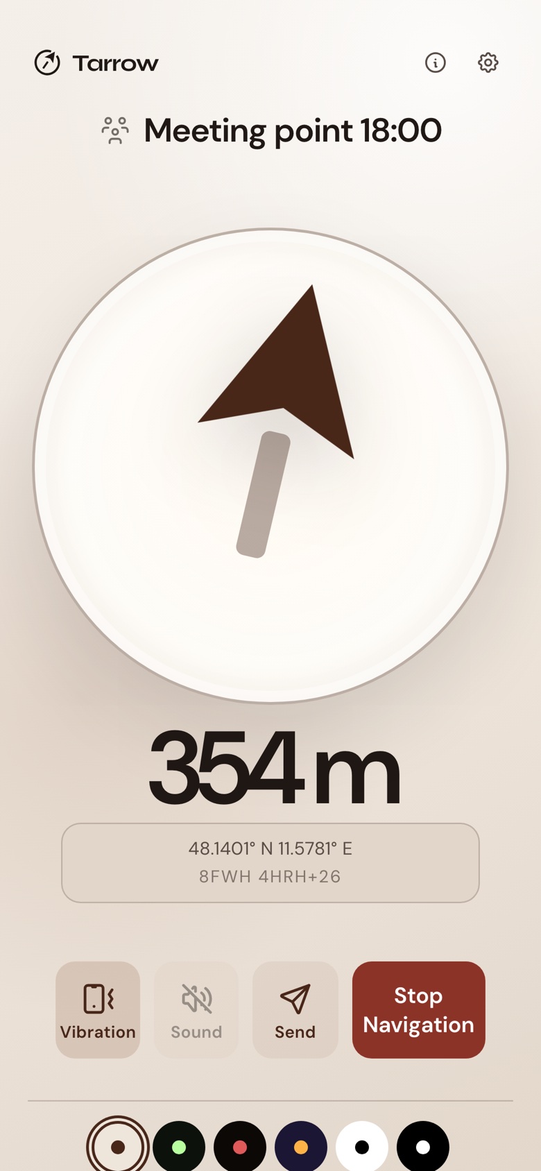
Send someone a place Their phone shows an arrow to it
You enter an address, a map link or coordinates and get a link. When the other person opens it, their phone shows an arrow pointing toward that place and how far away it is. It works in the browser, with nothing to install.
A compass points north. This arrow points to the place you chose.
Scenes
Where this helps.
How it works
Three steps.
01
Enter a place
On the Pick a place page, type an address or paste what you have: a link from Google Maps or Apple Maps, coordinates, or a Plus Code. Then put the crosshair on the exact spot on the map, if the address is not exact enough. The page turns it into a link you can send.
02
Send the link
Send it the way you send anything: WhatsApp, iMessage, email. Messengers show a small preview under the link, so the other person sees what it is before they tap. They need no app and no account.
03
Follow the arrow
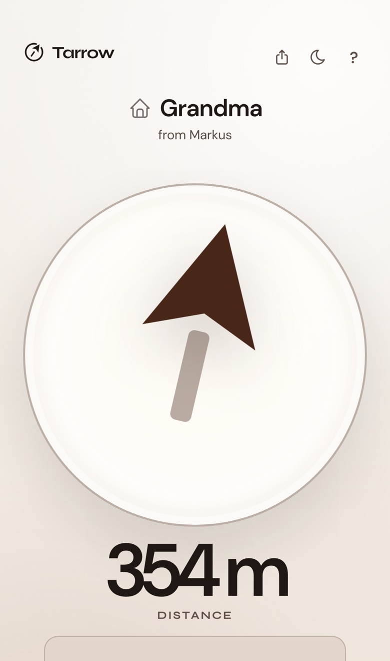
Their phone shows one arrow toward the place and the distance to it, no map. They hold the phone flat, turn until the arrow points ahead, and walk. Direction and distance update with every step.
All 12 accepted formats
Google Maps
Apple Maps
OpenStreetMap
Bing Maps
Waze
Plus Code
Coordinates (DD)
DMS
DDM
N / E prefixed
Address
geo: link
On the map
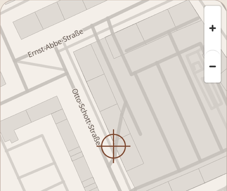
Mark the door, not the building.
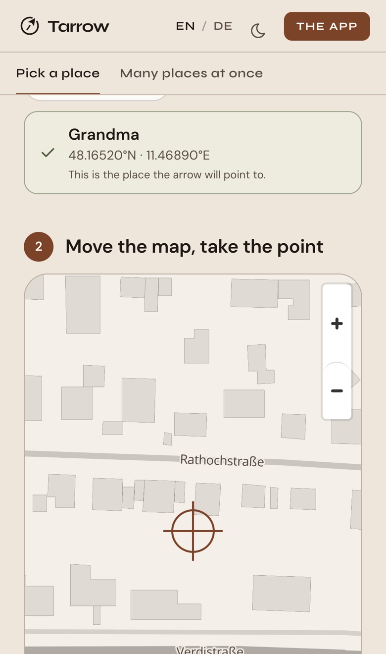
The map picker: building outlines and street names in one ink, a crosshair on the delivery entrance at the back of a large building
An address ends at a building, and a maps marker sits somewhere in the middle of it. On the map you move the crosshair onto the exact spot and take that point:
Everything here turns a place into an arrow. Send it in a message, print it, make many at once or put it on a website: those work in the browser, for anyone, without an account. The app is for the person who walks and keeps places.
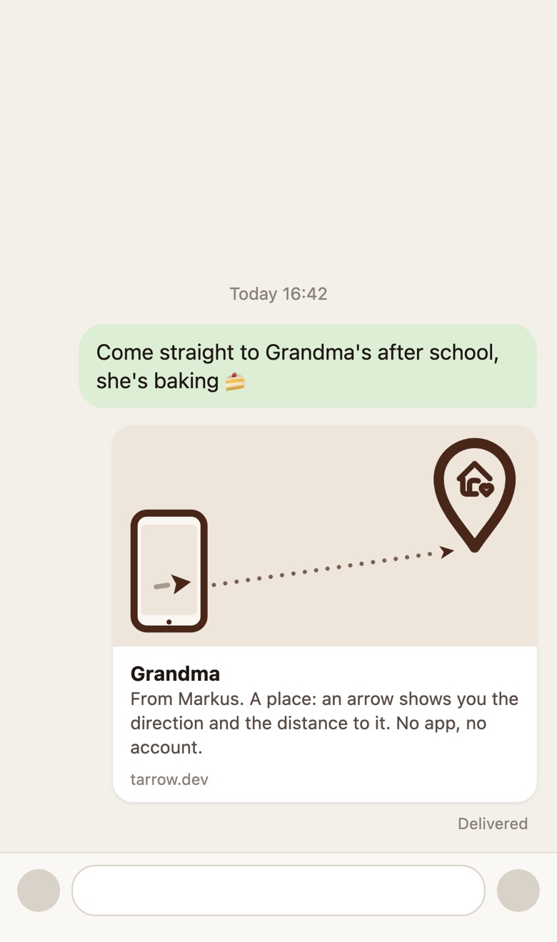
A chat message with a Tarrow link and its preview card: Grandma, an arrow, no app needed
You enter an address, a maps link or coordinates. Tarrow makes a link that carries the whole place: name, icon, a note, an end time if you want one. Whoever opens it sees an arrow and the distance, in the browser. No app, no account.
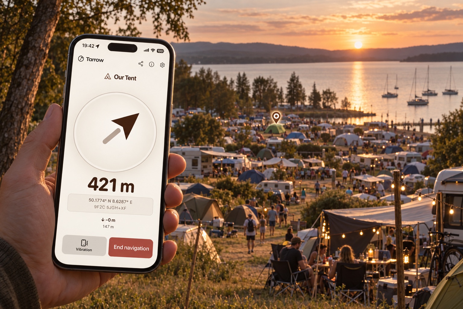
Example: “Our tent”, note “behind the showers, last row”, sent in a chat and opened on any phone.
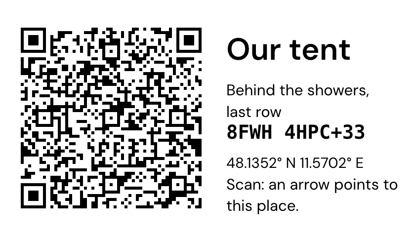
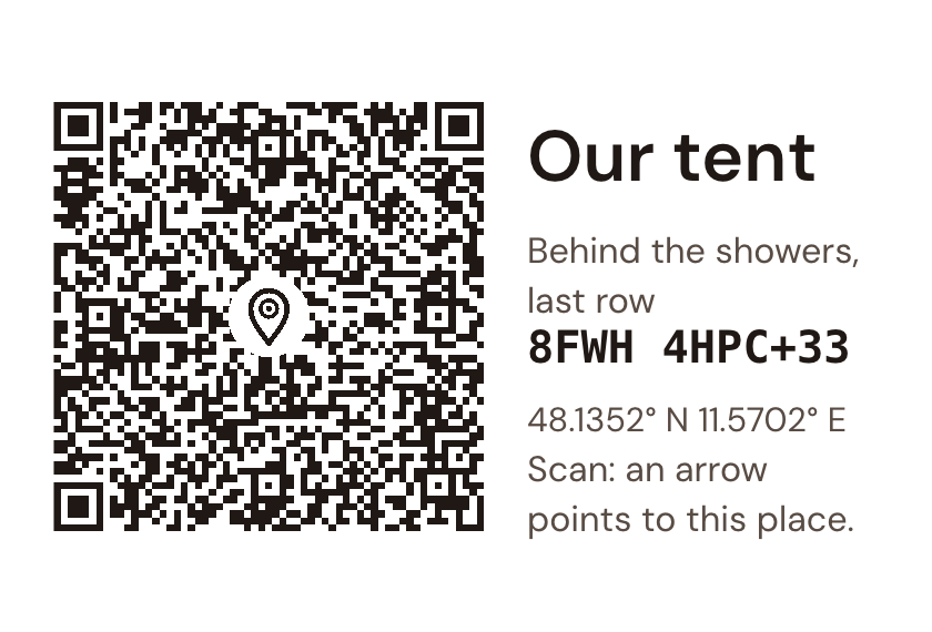
A 70 × 40 mm label: QR code, Our tent, the note, the Plus Code and coordinates · A 15 × 10 cm plaque for the same place, the Pin in the middle of the code
The same link as a code: on a label, a card, a plaque, a sign or a poster. You pick the product, download the file and print it anywhere; a thermal label printer works, so does a print shop.
Below: the label and the plaque for “Our tent”, exactly as the page renders them.
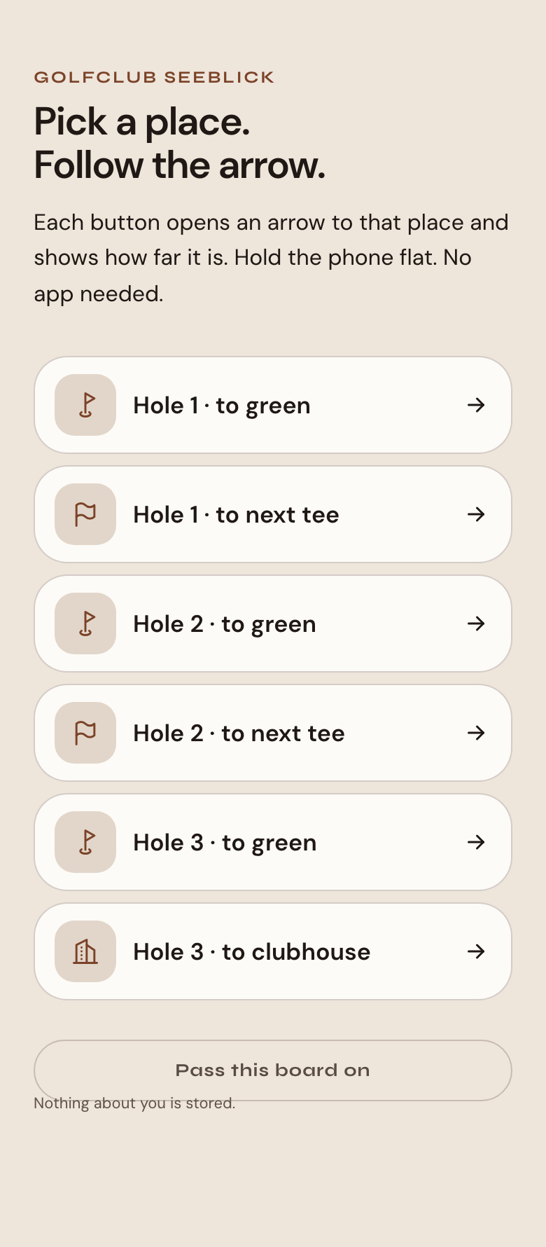
Paste a list, a spreadsheet, a GPX file or one place per line, and get a code for every place in the product you need. Templates know what a campsite, a golf course or an event needs. The whole list lives in its address.
Below: a golf course’s board, three holes and the clubhouse, as a visitor sees it on their phone: one button per place, an arrow behind each.
A venue puts one picture with a link next to its address. A visitor who is already close taps it on their phone and gets the arrow to the entrance. No script, no account, no cost; maps for the journey, the arrow for the last stretch.
The picture is the banner itself, in three steps: tap, see direction and distance, follow the arrow.
The same code as a tag for a 3D printer: a 2 mm plate with the modules raised 0.6 mm, downloaded as 3MF or STL. Two colours from two filaments, or from one change of filament at 2 mm; a 0.4 mm nozzle and 20 minutes. It hangs on a gate, a tent pole, a keyring, and it scans for years.
The drawing is the model itself, as the printer gets it. The first tag came off a Bambu Lab A1 on 27 September 2026 and scanned at the first try.
Direction and distance.That is all the arrow shows, and for the last few hundred metres, all you need.
Streets are the map’s job. The arrow keeps to the straight line.
A map app tells you which streets to take. The arrow only tells you where the place is from where you stand: the direction and the straight-line distance. That is enough for the car in a big parking lot, your tent among hundreds, a friend somewhere in the crowd.
It also works where maps struggle: no street, no address, and no mobile data once the page has loaded. Nothing about you is stored or tracked, because the page has no account, keeps no history and does not send your position anywhere.
The same arrow works for a parking spot and for a place on the other side of the world.
Works without a signal
No account needed
App planned as a one-time purchase, no subscription
No analytics or tracking
Your places stay on your phone
The app adds vibration: you turn slowly, and the phone pulses when you face the place, so you can keep your eyes on the path. It also keeps the places you use often, and works without any signal. What the app adds →
Free on the web · App in beta
Try it.
Creating a link is free and needs no account. The app adds the vibration, saved places and offline use; it’s in beta for iPhone, Android follows later, and it will be a one-time purchase, not a subscription. What the app adds.